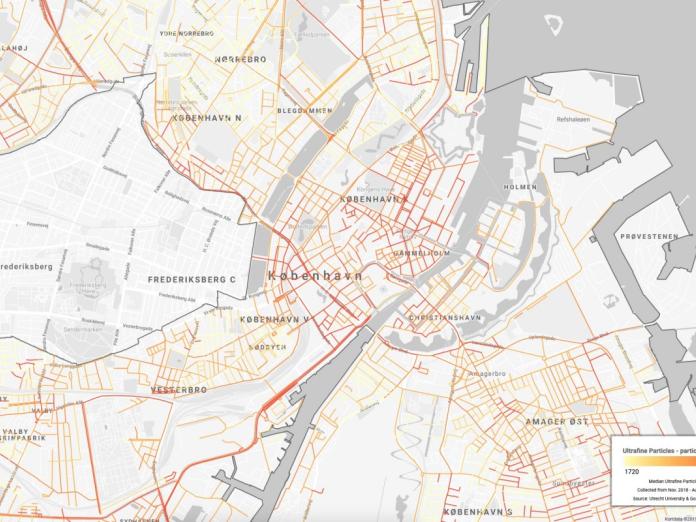
New map of air pollution in Copenhagen
About a year ago, our collaboration with Google began to measure street-level air pollution throughout Copenhagen. The map on this page presents the first half of the measurements for the ultrafine particles and soot particles. Both types of particles are often referred to as potentially very harmful as they are so small that they are not trapped in the lungs but are transmitted to the bloodstream and thus all organs in the body.
The map presents the preliminary conclusions that still should be further elucidated. Overall, it shows high air pollution values along major highways and in the inner city. The high air pollution on the roads are probably due to the big amount of traffic that emits a lot of particulate pollution. The high air pollution in the inner city may possibly be explained by narrow streets which hold the particle pollution. However, in both cases, other causes and sources of emission may also be at stake.
Measure air quality by putting measurement equipment on a car and measure all streets is suitable for finding the exact location of particular local conditions that can either be directly dealt with or need to be further investigated. This local knowledge can also be used in conjunction with other knowledge, such as population density to prioritize efforts.
On the other hand, the method also has limitations, for example in relation to the fixed measuring stations in Copenhagen. These are more suitable for providing accurate annual averages based on fixed measurements and minute corrections on a wide range of background variables such as weather conditions. Therefore, the values shown on the map can also be used for comparison with annual average values from the National Center for Environment and Energy (DCE).